Geocoding is the first step in almost any property risk workflow. An address goes in, and a pair of coordinates comes out. Every decision downstream inherits that point.
If the point lands on the wrong building, the rest of the analysis follows it there. The underwriter prices the wrong roof, the wrong construction, the wrong occupancy. An automated pipeline does the same thing faster.
The failure is not always dramatic. Consider a point that lands a few meters off, on a creek beside the insured building. The hazard model reads that location and returns a high flood score, even though the property does not face that risk. The distance was small, but the consequence was not.
This is why the accuracy of a single coordinate deserves scrutiny.
The question
Three providers lead commercial geocoding. Google, Here, and Smarty. Each returns an accuracy label with its result, and each has a top tier it calls "rooftop." Buyers tend to choose one provider, trust its label, and move on.
We could not find a clear, evidence-based answer to a basic question. Which of these is most accurate for commercial property insurance? Here is our analysis.
The dataset
We used 2,205 real commercial property addresses drawn from our own pipeline. These are locations our customers have evaluated for commercial property coverage, not a synthetic or catastrophe-weighted sample. The geographic spread matters, because the conclusions depend on the mix of places tested.
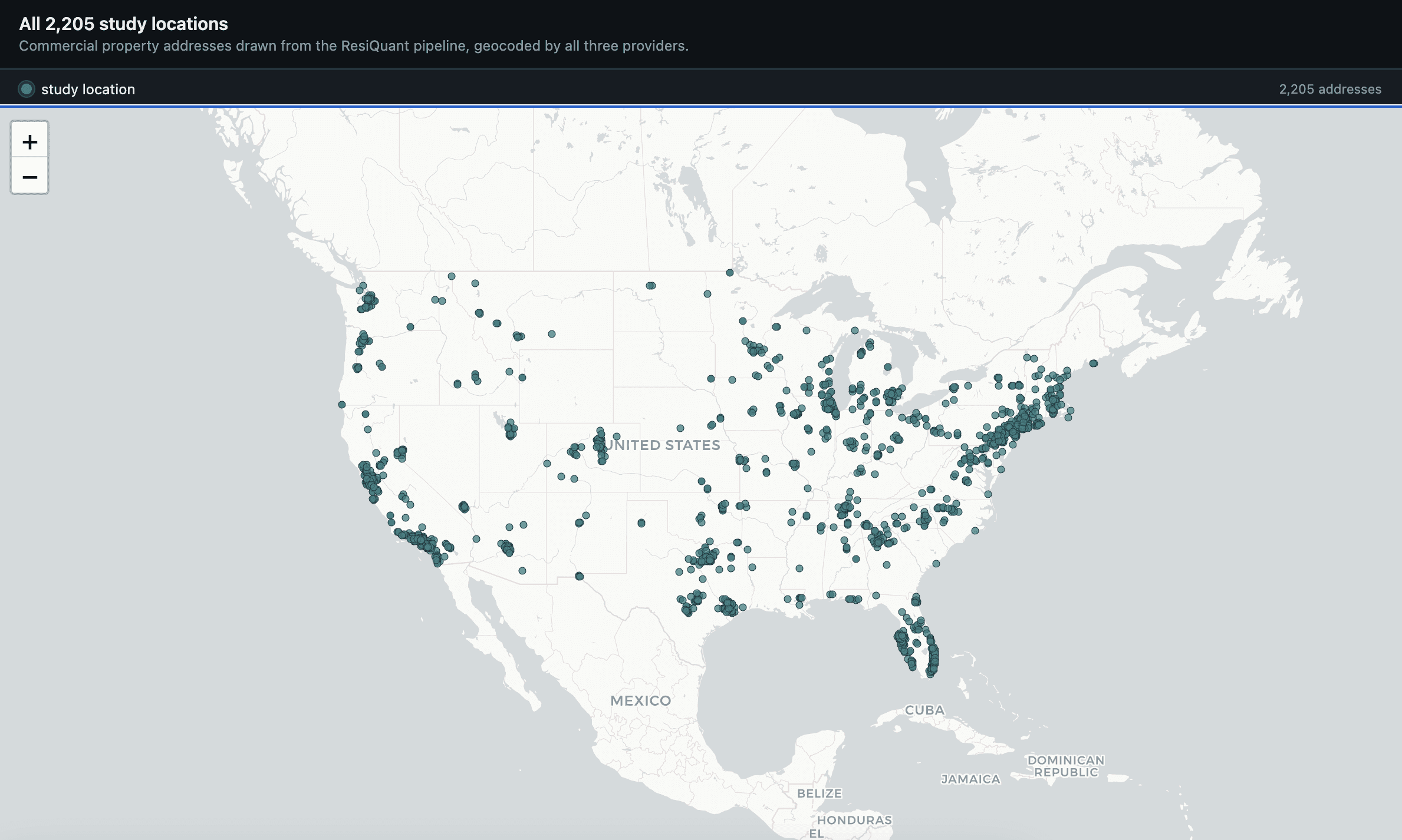
We geocoded every address with all three providers and kept each provider's coordinates and accuracy label.
How we measured accuracy
We ran three independent tests. They move from what the provider claims toward an outside source of truth.
The first test is self-reported accuracy. What label does the provider assign to its own result?
The second test is parcel accuracy. Does the coordinate fall inside the correct parcel? We used parcel boundaries manually verified by our team, drawn from county records, as an independent ground truth. Google Maps and the geocoders share underlying data, so they cannot check each other. The parcel boundary is defined outside all three.
The third test is rooftop accuracy. When a provider labels a point "rooftop," does the point actually sit on a building?
A result is a success only when the last two hold together. The point is on a roof, and that roof is on the correct parcel.
We treat error as binary. Outside the parcel is wrong. Off the roof is wrong. Off by fifteen meters or off by fifteen miles, the downstream effect is the same. You analyze the wrong building.
Test one. What the providers claim
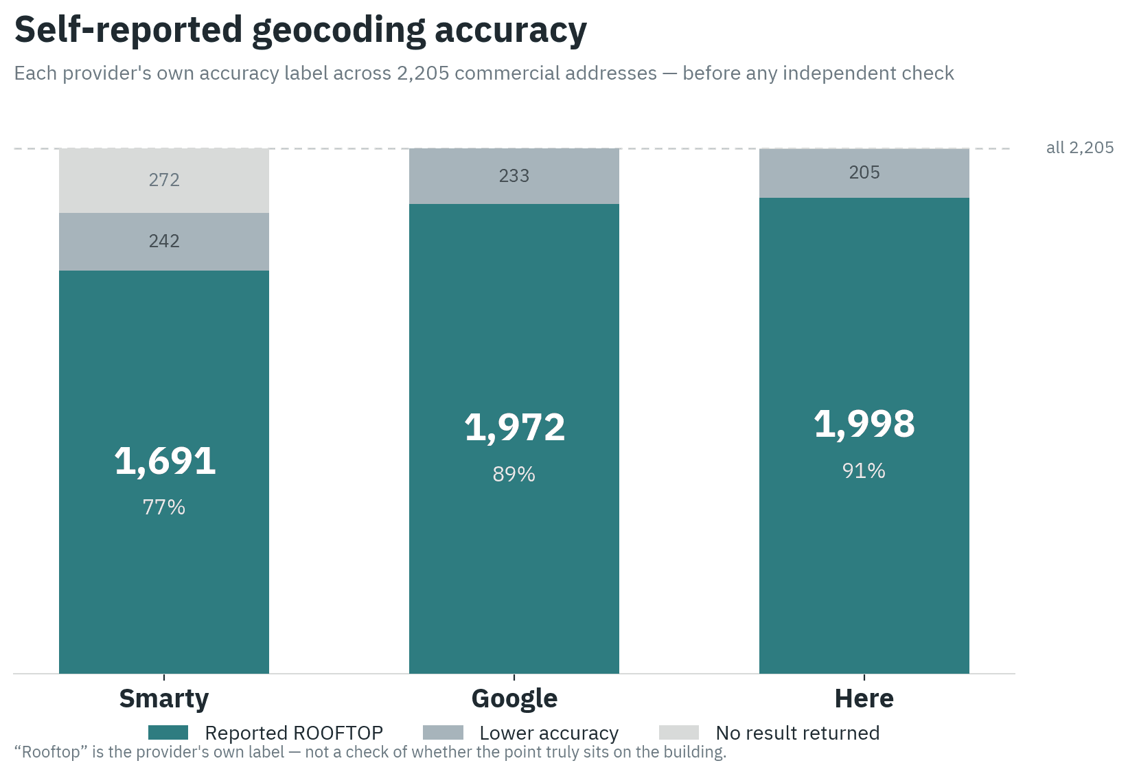
Here is the most confident provider. It labels 1,998 of 2,205 results as rooftop, about 91%. Google follows at 1,972, about 89%. Smarty is lowest at 1,691, about 77%, in part because it returned no result at all for 272 addresses.
Read on its own, this table rewards confidence. It says nothing about whether the confidence is warranted.
Test two. Does the point fall in the correct parcel
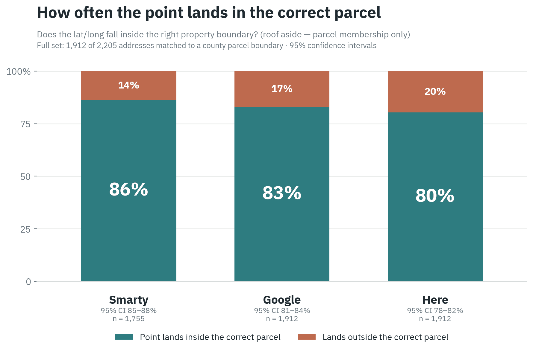
We matched 1,912 of the 2,205 addresses to a parcel. The remaining addresses, mostly rural, could not be matched to a boundary and are excluded here. These rates cover only the points each provider returned and matched, so they are not comparable to the 2,205-address totals above.
Smarty places 86% of its points inside the correct parcel. Google reaches 83%. Here reaches 80%. On this test the providers are close. Roughly one in five points lands on the wrong parcel for every one of them.
Test three. Is a rooftop really a rooftop
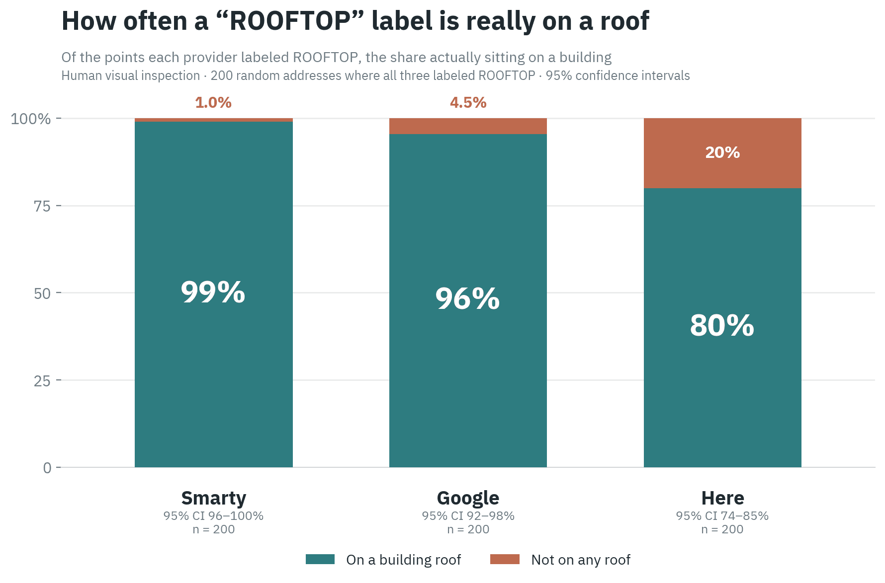
This is where the self-reported ranking reverses. Of the points each provider called rooftop, Smarty actually sits on a building 99% of the time. Google reaches 95.5%. Here reaches 80%. One in five of Here's rooftop claims is not on a building at all.
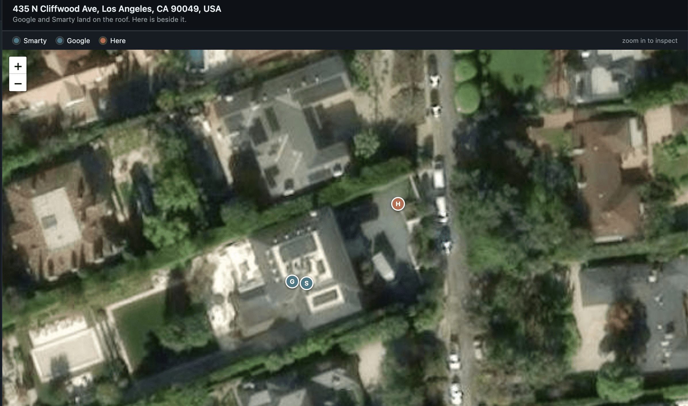
A few examples show what these failures look like on the ground. In the first, one provider reports rooftop while its point sits beside the building, and the other two land on the roof.
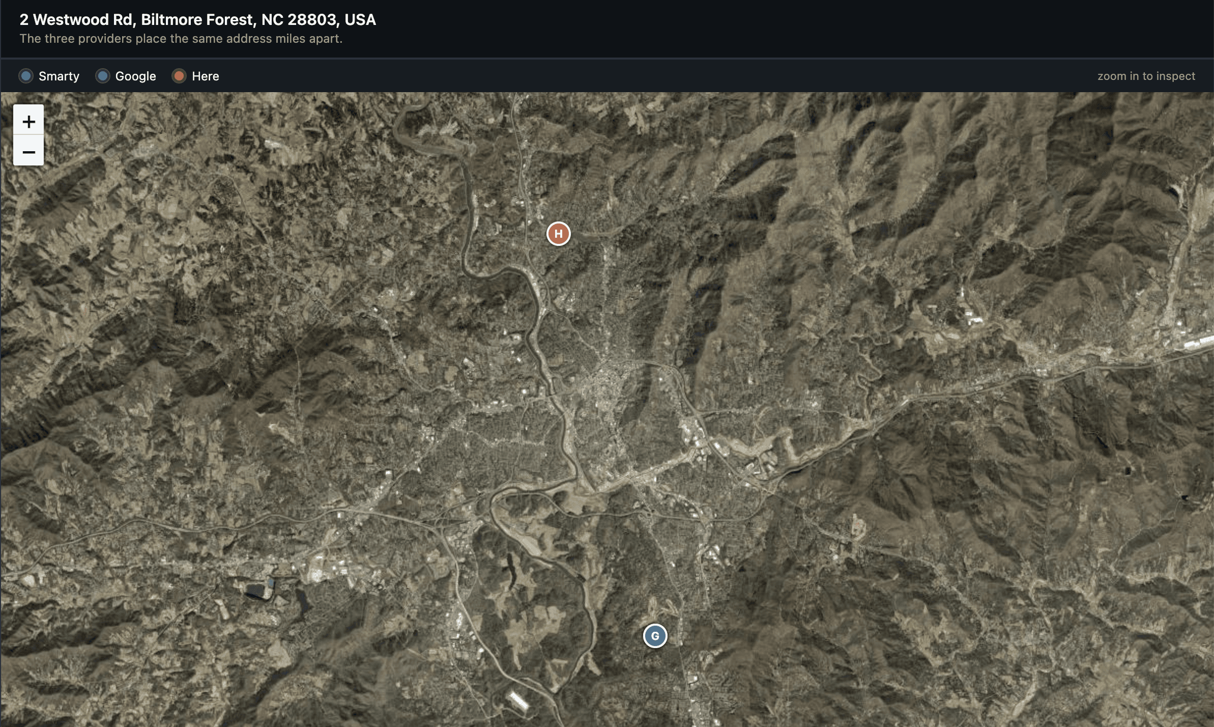
In the second, the providers scatter far enough apart that at least one is on an entirely different property.
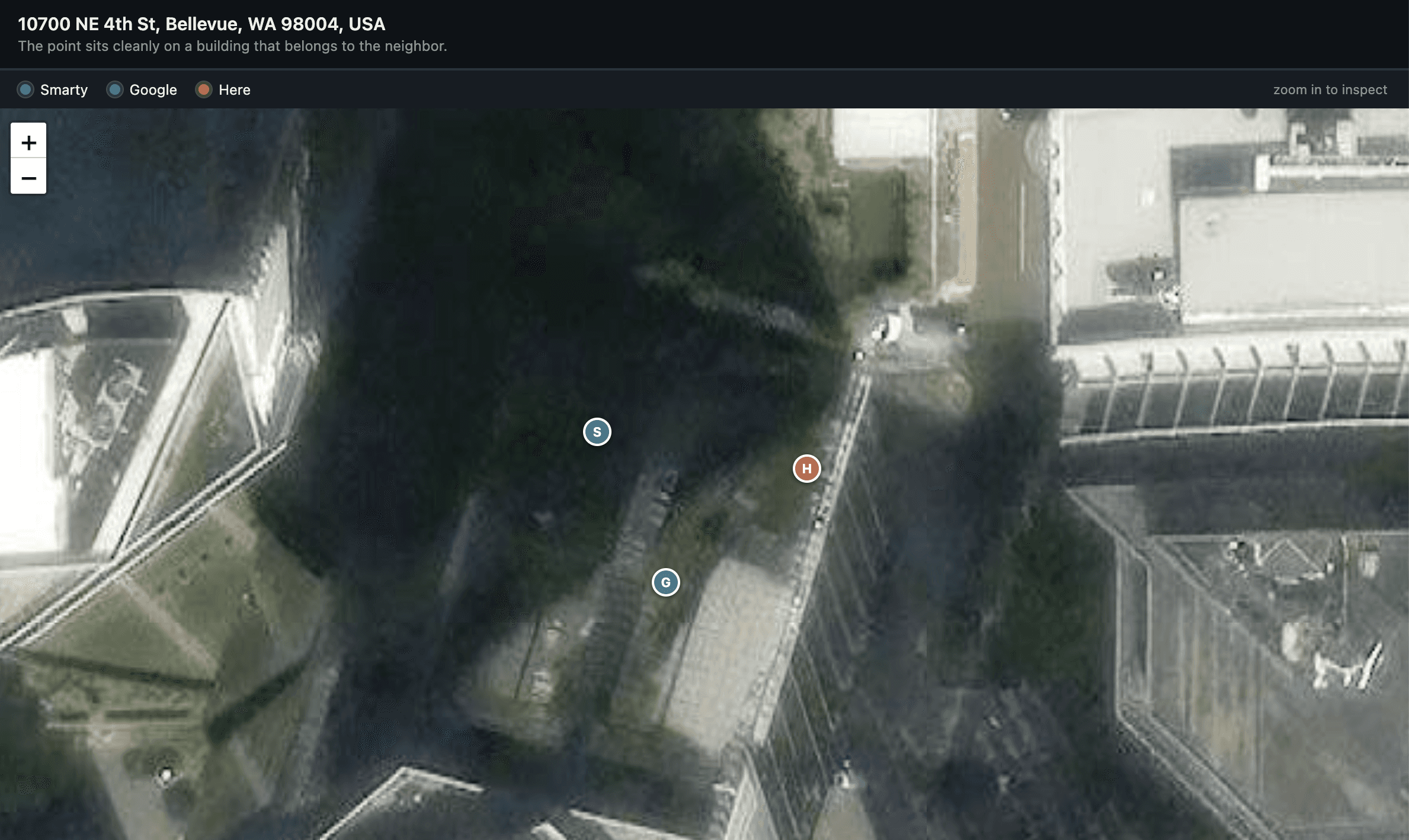
In the third, a point sits cleanly on a roof, but the roof belongs to the neighbor.
The three tests together
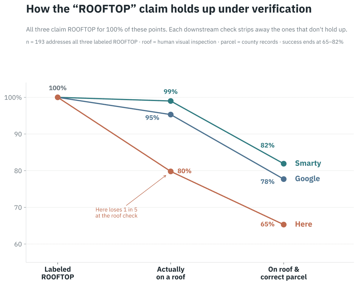
Every provider claims rooftop for these points. Each check strips away the results that do not hold up. By the time both conditions apply, on a roof and in the correct parcel, the numbers fall well below the headline figures.
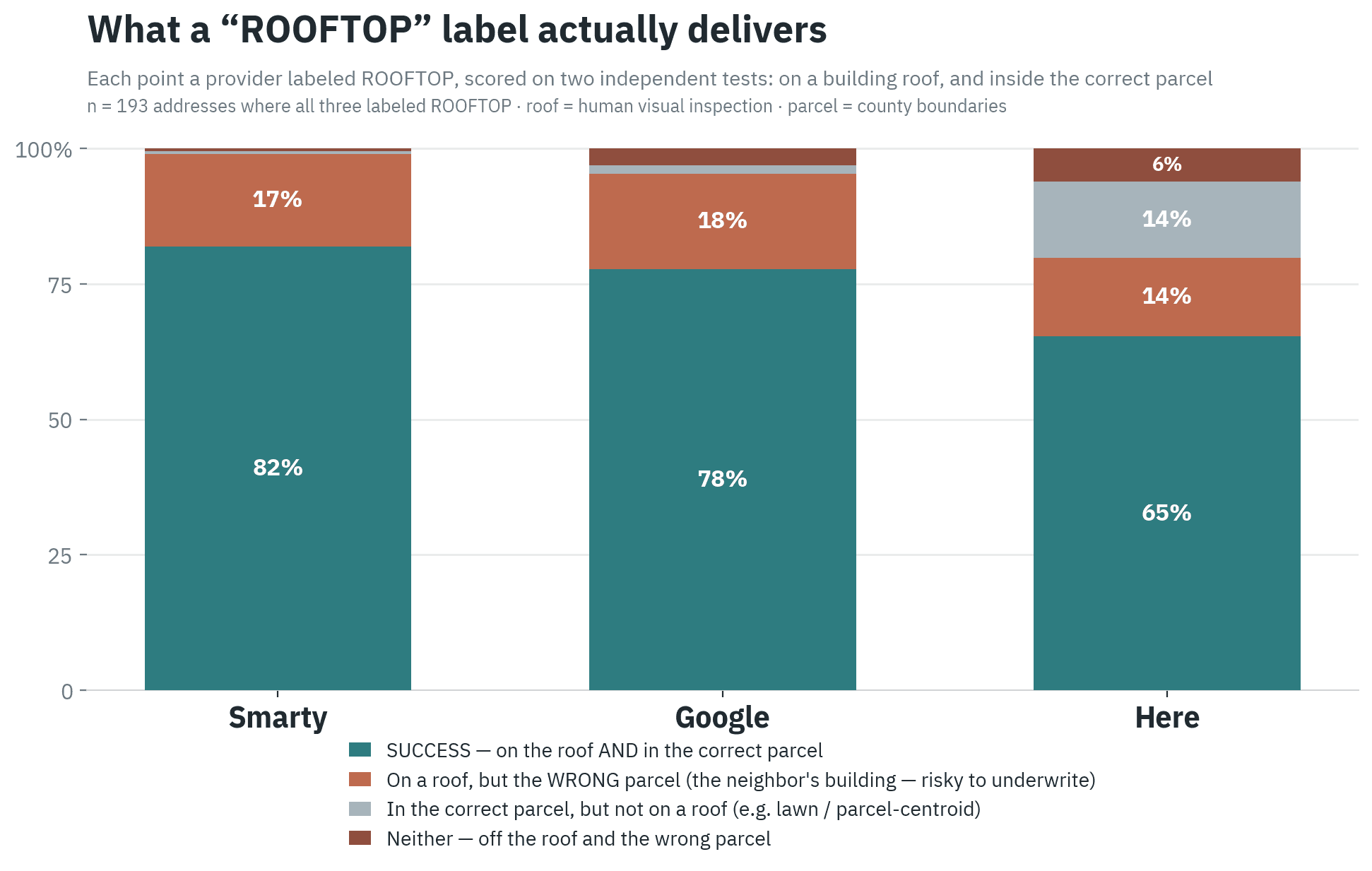
Smarty succeeds on 82% of the points it labeled rooftop. Google reaches 78%. Here reaches 65%. The most useful cell in this chart is the second one. About 17% of rooftop points, for all three providers, sit on a real building that belongs to the wrong parcel. The point looks perfect. It is on the neighbor's roof.
Can a blend do better
A natural response is to combine the three. Use consensus, or a fallback order, or an average. We tested all of these.
None of them beats the best single provider by a meaningful margin. If you could magically pick the best provider for every address, you would reach 83%. That is the ceiling. The reason is simple. The three providers tend to fail on the same addresses, and their errors point the same direction rather than canceling out. When the answer is not in any provider's output, no combination can recover it.
Where accuracy breaks down
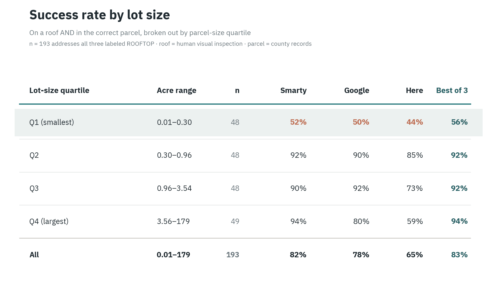
The failures are not spread evenly. They concentrate on small parcels.
On the smallest quartile of lots, success falls to the low fifties. Above roughly a third of an acre, every provider performs in the high eighties to low nineties. The cause is intuitive once seen. A dense urban lot is only a few dozen meters across. A routine geocoding error that would be harmless on a large lot is enough to cross into the neighbor's parcel. The error does not grow. The tolerance shrinks.
This runs against a common assumption that urban addresses are better mapped and therefore more accurate. On the test that matters for underwriting, the opposite holds.
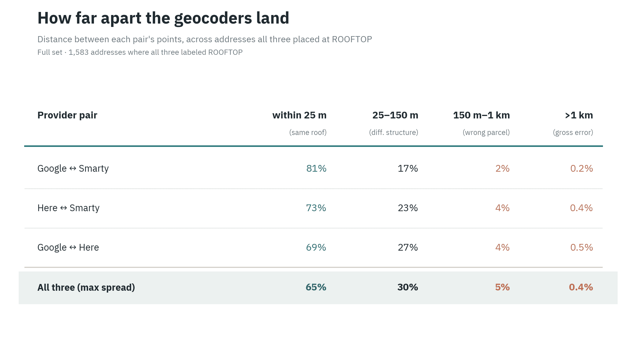
The distance between the providers tells the same story. On most addresses the three agree within a roof's width. On a small share they diverge across structures, parcels, or in rare cases miles.
What this means
No single geocoder is satisfactory for commercial property insurance. At best you are wrong about 17% of the time. On a portfolio of one million locations, that is 170,000 buildings analyzed in the wrong place.
Google and Smarty are both credible choices, and Here trails them. Smarty holds the highest verified accuracy on the roof and parcel tests. Google returns more rooftop results and costs less. Neither gap is large, and neither provider crosses the threshold you would want for automated underwriting.
This is the kind of problem we work on at ResiQuant. What the study points to is clear. The most reliable path is to bring in parcel boundaries as independent ground truth, and to use AI vision to check each provider's point against the imagery and the parcel, then adjust the location when the evidence warrants it. No single provider has to be right, because the decision draws on all of them and the ground truth together.
Getting the building right is the first step in getting the risk right.